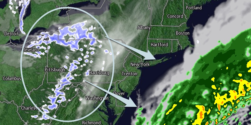
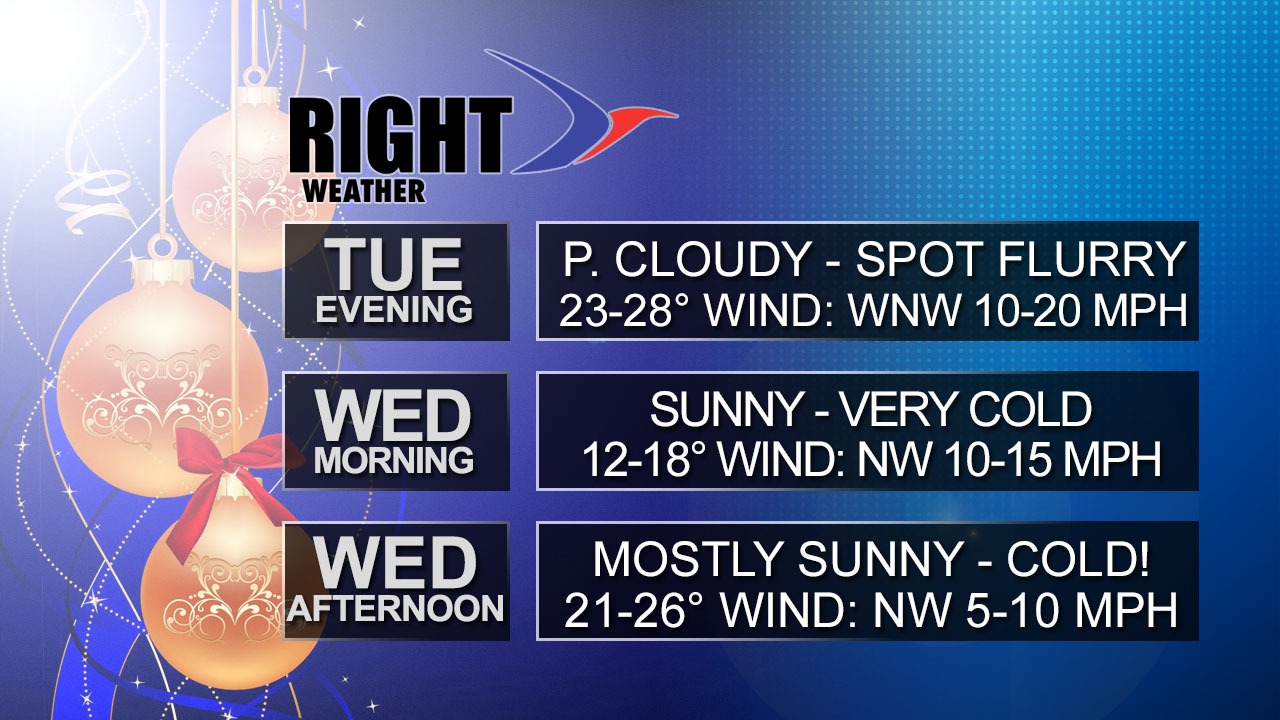
The weather will improve on Tuesday as the cold front responsible for the soggy, raw Monday moves offshore into the Atlantic Ocean. Dry, breezy, and cold weather will move into the Northeast in its wake. The temperature early in the day will be in the upper 20s to low 30s, and there may be a few slick spots if some remnant puddles from Monday’s rain do not dry overnight. It will be a partly cloudy day with a gusty northwesterly breeze. Highs will be in the low to mid 30s with a 10-20 mph northwesterly breeze.

A few flurries or snow showers may drift through Southern New England on Christmas Eve. The best chance of seeing any flakes is in CT, and there should not be any snow accumulation. The odds favor partly cloudy and dry skies for RI and SE MA. The temperature will fall through the 20s into the teens Tuesday night as skies clear after midnight. It will not warm up much on Christmas Day after starting the day in the teens. It will be among the coldest Christmas high temperatures since 1932 in the Providence area.
Clouds will increase on Thursday morning as a weak disturbance passes by. A few snow showers are possible, but no accumulation is expected. Highs will be in the upper 30s on Thursday.
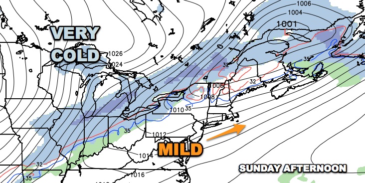
The weather will be quiet, with a warming trend through the weekend. Highs will range from the mid 30s on Friday to the mid to upper 40s by Sunday afternoon. All signs point to colder weather to ring in the New Year next week.


