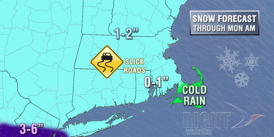
The temperature will rise to slightly above freezing from south to north early Wednesday, and the snow will change to sleet, freezing rain, then rain. The Monday morning commute could be slick, especially on untreated side roads. The National Weather Service has issued a Winter Weather Advisory for part of SNE.

Monday looks like a dreary day, with passing rain showers and drizzle, and temperatures in the 30s to low 40s. It will become partly cloudy Monday night. The temperature will fall below freezing by early Tuesday morning. Patchy black ice is possible.
A storm system will scoot by south of Southern New England on Tuesday. Snow showers cannot be ruled out, and there could be a minor accumulation – especially near the coast. Highs will only be in the low to mid 30s on Tuesday – and that is a sign of things to come. The temperature will drop into the 20s Tuesday night under clearing skies. Wednesday will be partly sunny, brisk, and cold. Highs will be in the low 30s.
The high temperature may not reach 30° late in the workweek. Lows will be in the teens to low 20s. By comparison, the normal high temperature for this time of the year is in the low to mid 40s. Thursday and Friday will be dry and breezy, with an afternoon wind chill in the teens to low 20s. It will stay very cold into next weekend.


