A messy winter storm is in the forecast for Wednesday in Southern New England. The storm will start as snow, but mixed precipitation is very likely to get involved in most of RI, SE MA, and CT. A burst of moderate to heavy snow is likely during the morning commute in all of Southern New England.
TIMELINE
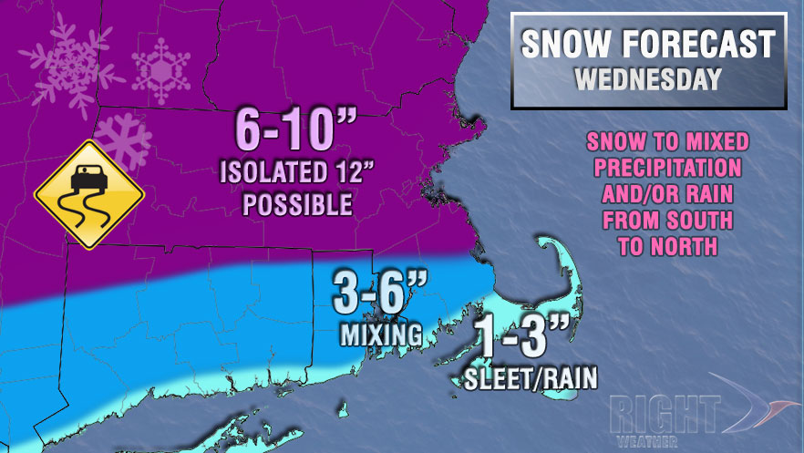
The snow will start between 3-5 am, and become moderate to heavy between 5-8 am. Several inches of snow should accumulate in many places by 10 am. Milder air a few thousand feet up in the sky will change the snow to mixed precipitation near the coast between 9-11 am, and in the Providence area between 10 am – 12 pm. The change to mixed precipitation, mainly sleet, will help to limit the snowfall totals in Southeastern New England. Most of RI, SE MA, and CT should see less than 6″ of snow from this storm. The best chance of 6-10″ of snow is in Massachusetts from the Berkshires east to Boston.

The heaviest precipitation will end early in the afternoon, and lighter, mixed precipitation or rain is likely for the rest of the afternoon. A change back to snow showers or flurries is possible during the evening, and the temperature will fall back into the 20s Wednesday night.


