The temperature reached 90° in most of Southern New England on Thursday. A sea breeze helped to cool the coast, including Eastern MA, in the afternoon, but the temperature continued to rise into the low to mid 90s elsewhere. Providence reached 96° before a southerly wind kicked in. The low temperature in Providence was 77°, which set the record for the high minimum temperature on the date. Similar records may be set in the next couple of days.

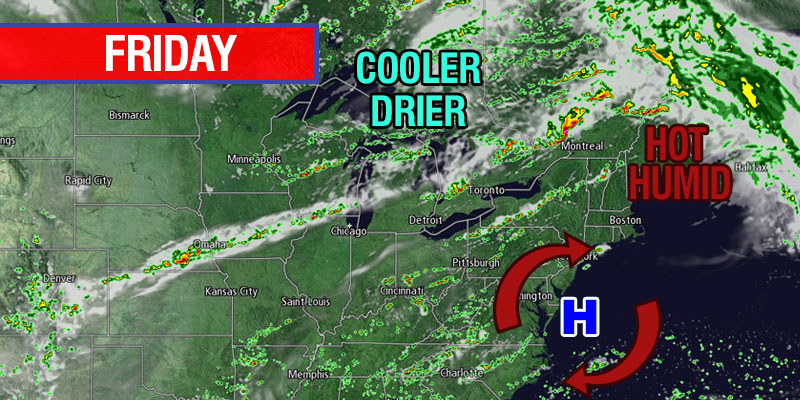
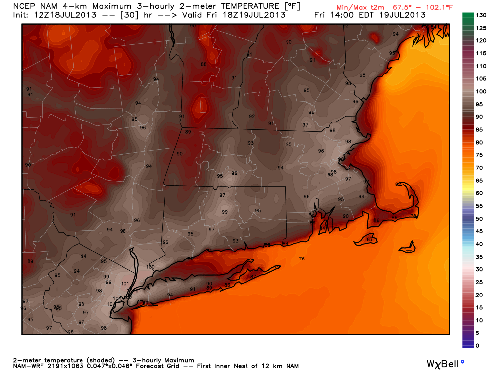
Friday will feature more searing heat, with the temperature reaching 90° by mid to late morning in most of Southern New England. There will not be a sea breeze on Friday. Instead a steady southwesterly breeze will develop. That means the south coast of Southern New England will feel the cooling effects of the ocean. Places like Boston, however, that experienced an onshore breeze on Thursday, will see the temperature soar into the mid 90s as the hot wind blows across Southeastern MA. The combination of heat and humidity will lead to a heat index above 100° away from the coast. Heat Advisories and Excessive Heat Warnings are in effect. It will be very humid near the coast, and it will feel like the 90s even though the temperature will be in the mid 80s during the afternoon. An Air Quality Alert is in effect due to elevated ground level ozone.
A passing thunderstorm is possible, but not likely, on Friday afternoon. The best chance of thunderstorms is on Saturday when a cold front arrives to finally put an end to the hot stretch. It will be very muggy and warm on Friday night. Once again, the temperature will struggle to drop into the 70s in the cities. The temperature will reach the mid 80s by mid-morning Saturday, and another high temperature in the low 90s is likely as the cold front is not expected to arrive until Saturday afternoon or night. The threat of a strong to severe boomer increases during the day on Saturday. The thunderstorm threat lasts into the night as the front slowly moves through. Right now, it looks like thunderstorms will be scattered, but there is the potential for some strong to severe storms with gusty wind and torrential rain.
Sunday will be cooler and a bit less humid, but it will most likely not be a drastic change. Look for highs in the mid 80s with dew points in the mid 60s – typical “dog days” weather. It should become partly cloudy after a cloudy start. The weather looks fair on Monday with the chance of showers on Tuesday.


