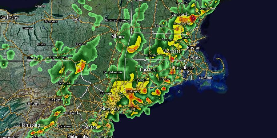
A hazy, warm, and muggy day is helping to destabilize the atmosphere, and an approaching cold front will be the trigger for widespread showers and thunderstorms to develop in the Northeast. Strong to severe thunderstorms are possible in Southern New England through Thursday night. The Storm Prediction Center has placed most of Southern New England under a slight risk of severe weather through the night.

The action before 6 pm will likely be scattered and over interior Southern New England. At the same time, however, an organized line of thunderstorms will be moving east from New York into New England by early this evening. The primary threats from the thunderstorms are strong winds, torrential downpours and frequent lightning. In Northern New England there is a slight risk of severe hail and a low chance of tornadoes. The thunderstorms may weaken upon entering coastal areas in the mid to late evening.
Anyone heading to Foxboro for the Patriots-Jets game needs to be ready for the rough weather. It is a very close call as to whether the organized line of storms will reach Foxboro area during the game.
There will be more rain, with the chance of thunderstorms, from after midnight into the morning commute in RI and SE MA. The forward progress of the cold front will slow a bit as it interacts with Tropical Storm Gabrielle when moving offshore. Showers may linger in E MA until midday Friday, with drier weather moving into Southern New England for the weekend.


